TL;DR
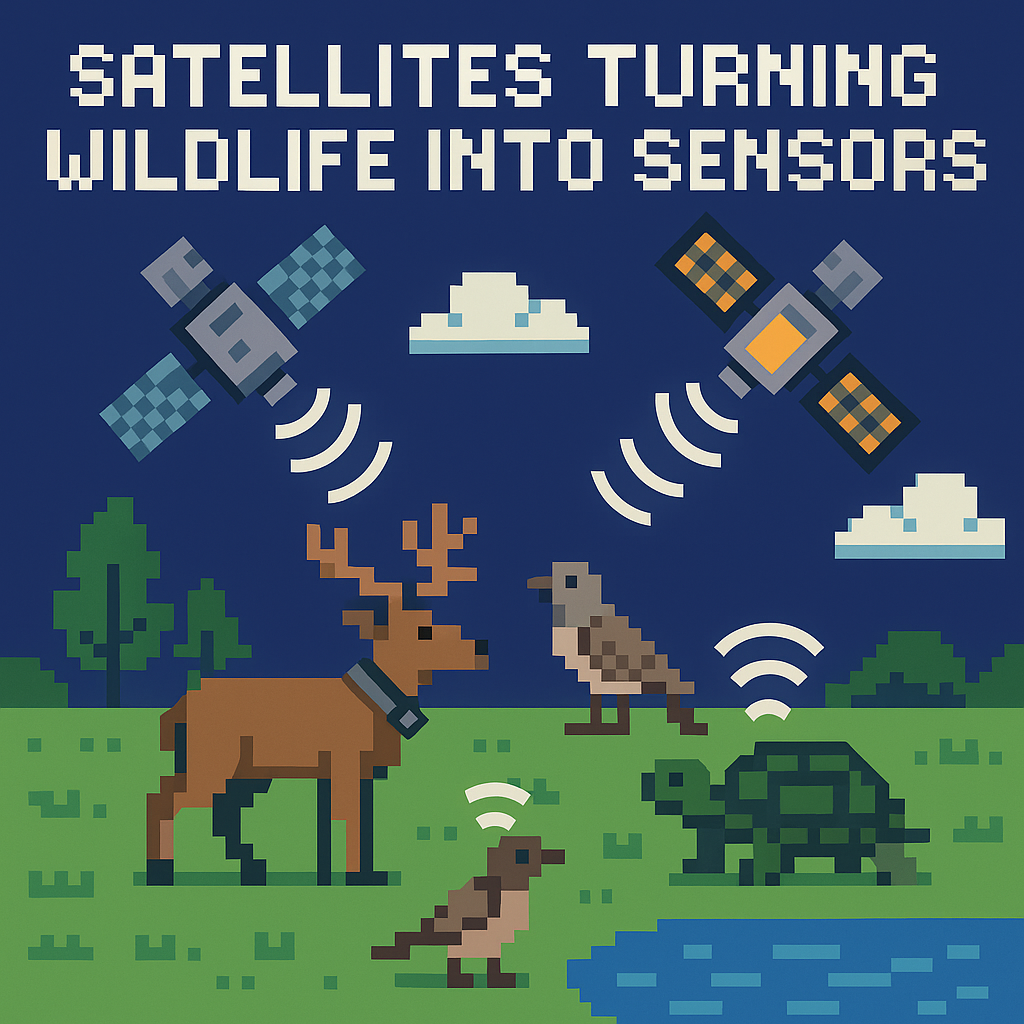
- Tracking animal panic from space just moved from demo to deployment: ICARUS 2.0’s “Raven” microsatellite launched on May 3, 2026, with more launches queued, turning wildlife into real-time sentinels for conservation and security. [2][3][4]
- The upside is clear—algorithmic “panic signatures” can flag human intrusions using accelerometer and topology features from tagged herds [6]—but the bottleneck is economics and ops: tagging 100,000 animals implies tens of millions in annual service fees plus nine-figure hardware. [1][8][9][10]
- The real fight won’t be in orbit; it’ll be in governance: data permissions, cyber-hardening of open-band tags, and integrating alerts into ranger playbooks without flooding teams with false positives. [6][7]
What the source said
The BBC Future piece on 21 May 2026 reports that scientists are training algorithms to read “patterns of panic” among wildlife—measurable movement signatures when animals react to threats—so rangers can interdict poachers in near real time. Testing at Namibia’s 169 km² Okambara reserve uses staged intrusions and drones to record dispersal patterns among species like springbok, zebra, and giraffe. The initiative plugs into ICARUS (“Internet of Animals”), a satellite-enabled system spearheaded by Martin Wikelski at the Max Planck Institute of Animal Behavior, with an ambition to tag 100,000 animals globally by 2030; modern tags capture GPS, activity, and vitals using solar and supercapacitors for multi‑year lifetimes. [1]
Why it matters
- For African parks agencies (SANParks in South Africa and MEFT Namibia), every minute shaved off response time can determine whether a 1,000‑kg white rhino walks away or becomes a carcass; a spaceborne “panic network” that triangulates humans via animal behavior extends ranger reach without adding patrol boots. [1][6]
- For technologists (Max Planck, Talos, EnduroSat, CTT, Telonics), wildlife telemetry is crossing a scale threshold: from isolated collars to constellations, from post-hoc datasets to operational systems, creating line items for hardware, airtime, and data ops alongside stricter stewardship for endangered-species data. [2][3][4][6][7]
Original analysis
Tracking animal panic from space: where the breakthrough really is
The news isn’t “we can tag animals.” It’s that ICARUS 2.0 restored and expanded the space segment lost after the ISS-based system went dark post‑2022, and it’s now on a clear cadence: a first receiver returned on November 28, 2025; the first independent Max Planck/Talos satellite, Raven, reached orbit on May 3, 2026; additional spacecraft are planned through 2027. That’s the pivot from research project to service. [3][2][4]
The second breakthrough is algorithmic. A 2021 Scientific Reports study demonstrated near–real-time poacher detection and localization using movement features from accelerometers and group topology, automating “panic signature” alerts without a human watching dots on a map. That’s what makes the method operational rather than a pretty visualization. [6]
But the hard part is below the headline. Who pays for 24/7 telemetry and alerting, and who owns risk when a false alarm pulls rangers off a hot zone? Movebank’s governance gives data owners control and embargo options for sensitive species, but operationalization means live streams, stricter access control, and auditable trails. The distance between a public database with delayed data and a secured, low-latency alert bus is non-trivial. [7]
Back‑of‑envelope: what does 100,000 tagged animals really cost?
- Hardware: Use a mid-range wildlife GPS/telemetry price point of ~$1,500 per collar (public agency budgets show that’s realistic). For 100,000 animals: $1,500 × 100,000 = $150,000,000 capex over the deployment cycle. [9]
- Connectivity/operations: A commercial satellite collar service at $35/month for one fix per hour is not unusual: $35 × 100,000 = $3,500,000 per month, or ~$42,000,000 per year. Many parks need more frequent fixes in hot zones, pushing opex higher. [10]
- Context: Older estimates put GPS collars at $800–$2,000 even before today’s satellite refresh; those bands still frame the order of magnitude. The economics aren’t crazy for a multiyear program, but they are programmatic, not “free with launch.” [8]
Math aside, this cost structure implies clear stratification: CTT LifeTags operating at 434 MHz for ubiquitous “sentinels” in SANParks units, heavier Iridium/Argos‑class satellite collars for apex indicators, and burst-mode fixes only when anomaly detectors trip to conserve airtime. [5]
A 2×2 to sort the tools that will actually scale
| High communications resilience (global, jam-resistant) | Low communications resilience (local, easy to jam) | |
|---|---|---|
| High signal fidelity (clear panic signatures) | Satellite collars (Argos/Iridium-class); ICARUS ear/neck tags feeding Movebank and real-time alerting. Pros: global reach; Cons: opex heavy. [2][3][7] | Local VHF/UHF tags + dense ground towers (Motus/CTT IoW). Pros: cheap tags; Cons: coverage gaps; unlicensed bands can be jammed. [5] |
| Low signal fidelity (coarser cues) | Constellation-linked acoustic/seismic arrays for elephants or gunshots; robust backhaul but noisy signals. [3][7] | Ad hoc camera traps or consumer drones without mesh backhaul. Pros: low cost; Cons: latency, manual review. [10] |
The right mix per park won’t be ideological; portfolios will pair ICARUS satellites and Movebank alerting with Motus/CTT towers and acoustic lines along known ingress routes to water points and fencelines. [2][5][7]
Contrarian read
- Consensus: “With enough tags and satellites, we’ll outpace poachers.”
- Counter: Poachers adapt faster than satellites launch. Expect radio jamming and data‑poisoning attempts against open-band tags (434 MHz is widely used), social engineering to access dashboards, and panic‑signature confusion during tourist high season. Without red‑team testing and rate‑limited alerting, you risk false-positive fatigue that hands initiative back to criminals. Governance and cyber are as critical as orbits and algorithms. [5][7][6]
Named-stakeholder breakdown
- Max Planck Institute of Animal Behavior (Martin Wikelski): Moves from science to service provider; must harden Movebank’s “operational edge” while growing a global user base in 2026–2027. [3][7]
- Talos (Germany) + EnduroSat (Bulgaria): Space hardware through 2027; success hinges on cadence and downlink latency SLAs that rangers actually feel during night patrols. [2][6]
- Cellular Tracking Technologies and Telonics: Beneficiaries of an “ear-tag first” model; they win if parks standardize on interoperable devices and data plans rather than bespoke one-offs across reserves. [5][11][12]
- SANParks (South Africa) and MEFT (Namibia): If live alerts shave minutes off intercepts, they can bend the poaching curve faster than dehorning alone; budgets must shift from capex to recurring telemetry opex in FY2026–FY2028. [1][10]
What others are missing
Coverage fixates on satellites and charismatic megafauna; the blind spot is the control plane. Movebank rightly lets data owners restrict sensitive streams, but an operational poaching alert bus needs zero‑trust policies, granular role-based access, and regionally mirrored infrastructure so a single compromise can’t de‑cloak endangered animals. Meanwhile, many low-mass tags operate on open 434 MHz or VHF bands, which are easy to jam or spoof without spectrum enforcement. Pair ICARUS alerts with authenticated, encrypted device telemetry and red‑teamed dashboards, or expect attackers to evolve from bolt cutters to SDR kits within a season. The decisive frontier isn’t orbital—it’s secure, boring systems engineering. [7][5]
What to watch next
- By Q4 2026, at least two African reserves will disclose arrests or interdictions directly triggered by ICARUS-linked “panic signature” alerts shared with rangers.
- By June 2027, ICARUS 2.0 will have at least four operational satellites on orbit, short of the publicly discussed six-satellite ambition but sufficient for sub-hour alert latency in southern Africa. [4]
- By 2027 migration season, a peer‑reviewed field study will show that mixed sentinel cohorts (e.g., zebra + giraffe + cheetah) improve poacher localization accuracy by >20% versus single-species tagging. [6]
My take
If conservation agencies want fewer carcasses and more live rhinos, they should treat ICARUS 2.0 and Movebank as critical infrastructure, not episodic grants: fund the satellite cadence anchored by Raven’s May 3, 2026 launch, subsidize telemetry opex for SANParks and MEFT units that standardize on vetted CTT/Telonics devices, and require third‑party red‑team audits before any alerting pipeline goes live. That blend of concrete financing, interoperable hardware, and boring-but-secure ops will do more in 2026–2027 than any single collar drop. [2][5][7][12]
Sources
-
We can now track animal panic from space. Here’s why it matters — BBC (https://www.bbc.com/future/article/20260521-tracking-animal-panic-from-space) — Field experiment at Okambara, ICARUS context, and the 100,000‑animal goal by 2030.
-
ICARUS launches second system into orbit — Max Planck Society (https://www.mpg.de/26446105/icarus-launches-second-system-into-orbit) — Confirms May 3, 2026 launch of the Raven microsatellite and outlines additional launches.
-
Icarus returns to space — Max Planck Society (https://www.icarus.mpg.de/126426/news_publication_25661928_transferred?c=2482) — Documents the November 28, 2025 return to orbit and partnership with Talos for subsequent receivers.
-
ICARUS – Tierbeobachtung aus dem Weltall — University of Konstanz (https://www.uni-konstanz.de/universitaet/aktuelles-und-medien/themen-schwerpunkte/max-planck-institut-fuer-verhaltensbiologie/icarus/) — University overview of the roadmap: first satellite in Nov 2025, second in spring 2026, target of six by mid‑2027.
-
Tag Deployment (Motus/CTT) — Motus Wildlife Tracking System (https://docs.motus.org/en/about-motus/quick-reference/tag-deployment) — Details CTT tag families (LifeTag/PowerTag) and their 434 MHz operation, relevant to scaling and security considerations.
-
Timely poacher detection and localization using sentinel animal movement — Scientific Reports (https://pmc.ncbi.nlm.nih.gov/articles/PMC7907380/) — Peer‑reviewed evidence that animal movement features can detect and localize human intrusions.
-
Movebank data policy — Movebank (https://www.movebank.org/cms/movebank-content/data-policy) — Explains owner-controlled permissions, embargo options, and handling of sensitive species data.
-
GPS collars help wildlife researchers answer important questions — Popular Science (https://www.popsci.com/story/technology/things-researchers-learn-from-gps-collars/) — Provides typical collar cost ranges ($800–$2,000) for context.
-
NDOW budget (GPS/VHF collars priced at $1,500) — Nevada Department of Wildlife (https://www.ndow.org/wp-content/uploads/2023/04/8a_Heritage-Proposals_NDOW.pdf) — Concrete public-sector pricing used in the cost model.
-
Margo Luminous Satellite Tracking Collar (pricing) — Margo Supplies (https://us.margosupplies.com/product/margo-luminous-satellite-tracking-collar/) — Lists $35/month data plan for one GPS fix per hour, anchoring opex assumptions.
-
TALOS and EnduroSat to Build “Internet of Animals” Satellite Constellation — EnduroSat (https://www.endurosat.com/news/talos-and-endurosat-to-build-internet-of-animals-constellation/) — Confirms TALOS–EnduroSat partnership and Raven’s role in the ICARUS 2.0 constellation.
-
GPS/Argos Solar Eartag — Telonics (https://www.telonics.com/products/gps4/gps-argos-eartag-solar.php) — Shows commercial availability of solar ear‑tag form factors for large mammals, relevant to sentinel deployment.
Related update: We recently published an article that expands on this topic: read the latest post.
